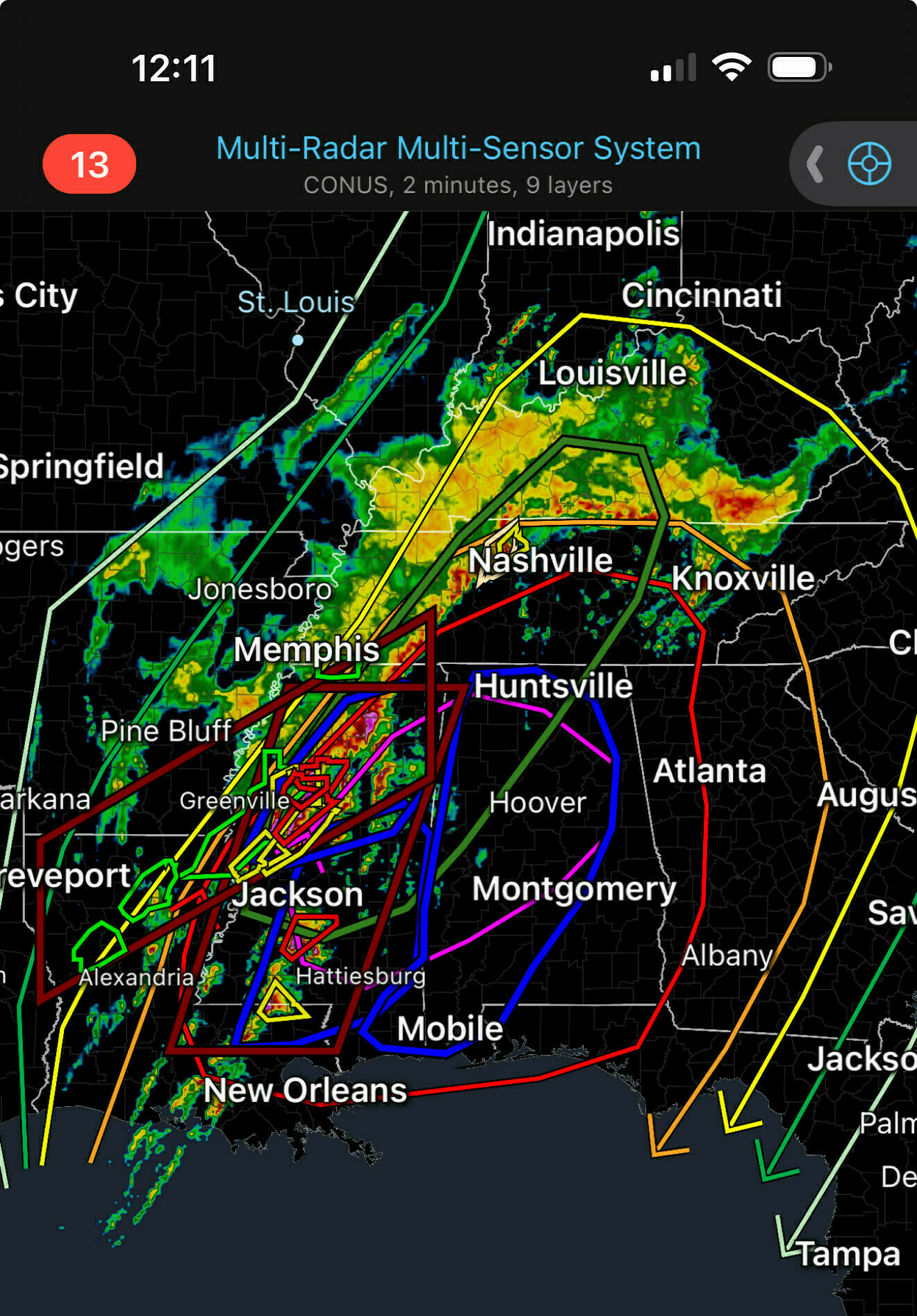
If you have that many colors on your weather map, it’s going to be a Bad Day.

```Weather radar map showing Multi-Radar Multi-Sensor System with CONUS, 2 minutes, 9 layers. Mobile phone display showing time 12:08 with alert number 13. Map displays severe weather systems across southeastern US with colored precipitation patterns and storm tracking lines connecting cities including St. Louis, Cincinnati, Louisville, Nashville, Knoxville, Memphis, Huntsville, Atlanta, Jackson, Montgomery, Mobile, and New Orleans. Various colored tracking lines (red, yellow, blue, green, purple) indicate storm movement paths.```
Edward Jensen @edwardjensen